
You can check FEMA flood maps for free by identifying the parcel, searching the official FEMA Flood Map Service Center, and comparing the effective Flood Insurance Rate Map with the parcel’s approximate location. This is a screening process—not a guarantee that the property will or will not flood.
Step 1: search FEMA’s official map service
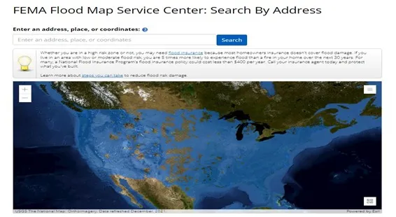
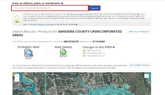
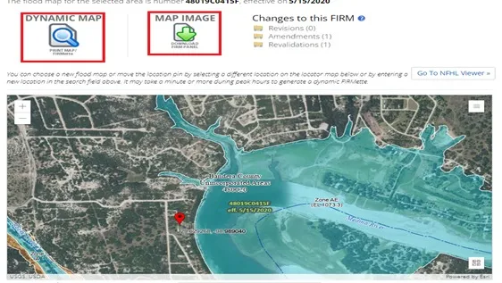
Go to the FEMA Flood Map Service Center, the official public source for FEMA flood-hazard products. Search by the best available address or coordinates, then check that the result is centered on the correct parcel area. If an address is not recognized, use coordinates from the approximate parcel location and verify latitude-longitude order.

Understand what the map can and cannot tell you
FEMA maps show mapped flood hazards used for the National Flood Insurance Program. They do not capture every local drainage problem, future storm, small channel, recent development change, or unmapped hazard. A zone designation also does not settle legal boundaries, building feasibility, insurance price, or whether a lender will require coverage.
FEMA describes shaded Zone X as moderate flood hazard and unshaded Zone X as minimal flood hazard. Zone X does not mean no flood risk. Zones A and AE are special flood-hazard areas; AE mapping generally includes base flood elevations, while some A zones do not. Coastal V and VE zones account for additional wave hazards. Always read the legend and notes on the effective panel rather than relying on color alone.
Step 2: identify the correct parcel
Start with the county assessor, appraisal, or property-records website. Search by owner, situs address, or parcel number. The identifier may be called a parcel ID, property ID, account number, or tax ID. It may also appear on a tax statement or deed, but placement and terminology vary. Match the owner, legal description, acreage, and location instead of relying on one number.
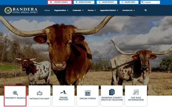
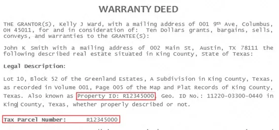

Tax and GIS records are useful indexes, not proof of ownership or boundaries. Deeds may omit a tax parcel number, and a parcel can involve more than one account or tract. Use recorded documents and a licensed surveyor when the legal description or boundary matters.
Step 3: locate the parcel in county GIS
Open the official county GIS link, accept its disclaimer, and search for the parcel. Use the map to understand roads, neighboring parcels, water features, and the approximate footprint. Record the address or coordinates for the correct location.
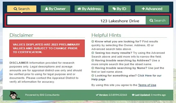
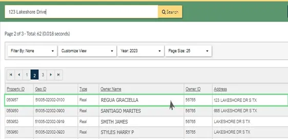
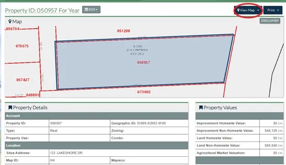
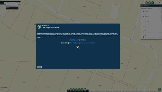
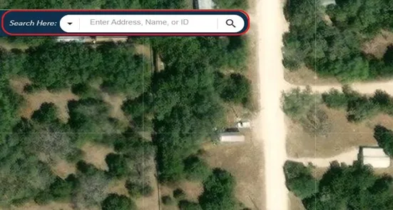
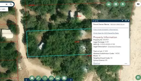
County GIS lines can be offset from aerial imagery and may not match a survey. Coordinates copied from a consumer map are also approximate. Do not represent a tax-map line or cursor location as the property corner.
FEMA address-search troubleshooting
- Verify the parcel first. Match the county property ID, owner or legal description, acreage, and nearby roads. A mailing address can differ from a situs address, and vacant land may have no recognized street address.
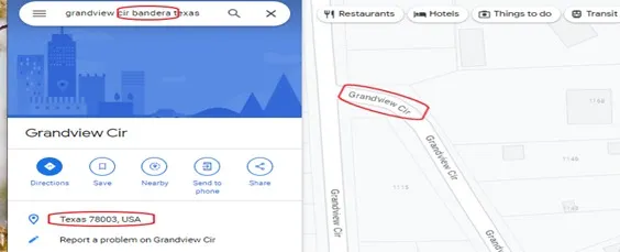
- Try the situs address. If FEMA does not recognize it, simplify the address and confirm the city, state, and ZIP rather than selecting a similarly named result.
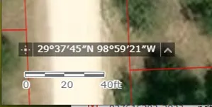
- Switch to an approximate point. Copy a point from well inside the parcel polygon in the official county GIS, following this approximate property-coordinate workflow. Enter latitude and longitude in the order requested and retain the west-longitude minus sign when using decimal degrees.
- Confirm the result. Check roads and water features, then record the community, panel number, effective date, zone label, and any Letters of Map Change shown.
- Escalate uncertainty. If the point is near a zone line, the parcel spans zones, the map is unavailable, or the address and coordinate results disagree, contact the local floodplain administrator. A surveyor or engineer may be needed to relate the effective map to the legal parcel and site elevations.
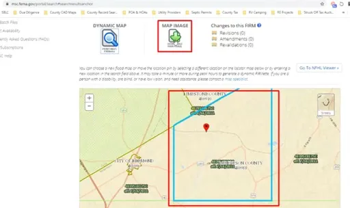
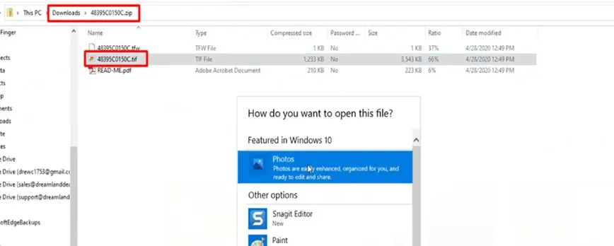
Review the available dynamic map and map image. Note the community, map panel number, effective date, zone label, floodway, and base flood elevation information if shown. Download the FIRM panel when you need the map legend, notes, and full context. Save a dated copy or screenshot for your due-diligence file, but return to FEMA before a later decision because maps and effective products can change.
How to find the Base Flood Elevation for a property
A Base Flood Elevation (BFE) is the elevation of surface water for the flood with a 1% chance of being equaled or exceeded in a given year. On the effective FIRM, FEMA says BFEs are shown for zones including AE, AH, A1–A30, AR combinations, V1–V30, and VE. Read the BFE number, elevation datum, cross sections, and zone together; do not compare a ground or building elevation that uses a different datum.
- In the Map Service Center, confirm the correct location and open the effective FIRM panel. Record the panel number and effective date.
- If the mapped zone normally carries BFEs, inspect the printed elevation labels and the map legend. Also open the effective Flood Insurance Study report through Search All Products; its flood profiles and tables may provide the context needed to interpret a riverine BFE.
- If the panel shows Zone A without a BFE, do not invent one from contour lines or a nearby labeled zone. Ask the local floodplain administrator whether the community has adopted or accepts another source of BFE or best-available data. FEMA explains that Base Level Engineering data can identify flood elevations in Zone A but supplements rather than automatically replaces the effective FIRM.
- If the location is in Zone X or another area where the effective panel does not display a BFE, record “BFE not shown on the effective panel” rather than “no flood risk.” Ask the local floodplain administrator whether another local study, drainage standard, or project-specific design elevation applies.
- For a building, ask whether an existing FEMA Elevation Certificate is on file. The certificate documents building and site elevation information for floodplain compliance, insurance, or a map-change request; it is not a boundary survey and does not create a missing FEMA BFE. A qualified surveyor, engineer, or authorized community official may be required for the relevant sections.
For Map Service Center navigation problems, FEMA directs users to its Map Information eXchange map specialists. For permitting, fill, grading, culverts, elevation standards, or an absent BFE, the local floodplain administrator remains the decision point.
Step 4: compare the parcel and mapped hazard cautiously
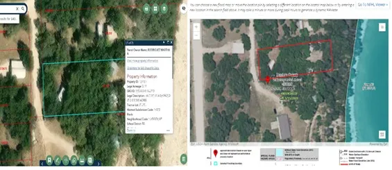
Place the county GIS and FEMA map side by side. Use roads, intersections, water features, and other landmarks to orient the approximate parcel. If a flood-zone line appears close to or across the property, do not estimate the legal result from the screen. A surveyor or engineer may be needed to relate the effective map, elevations, and parcel boundaries.
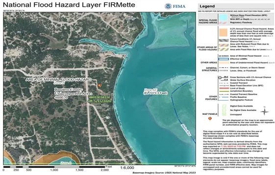
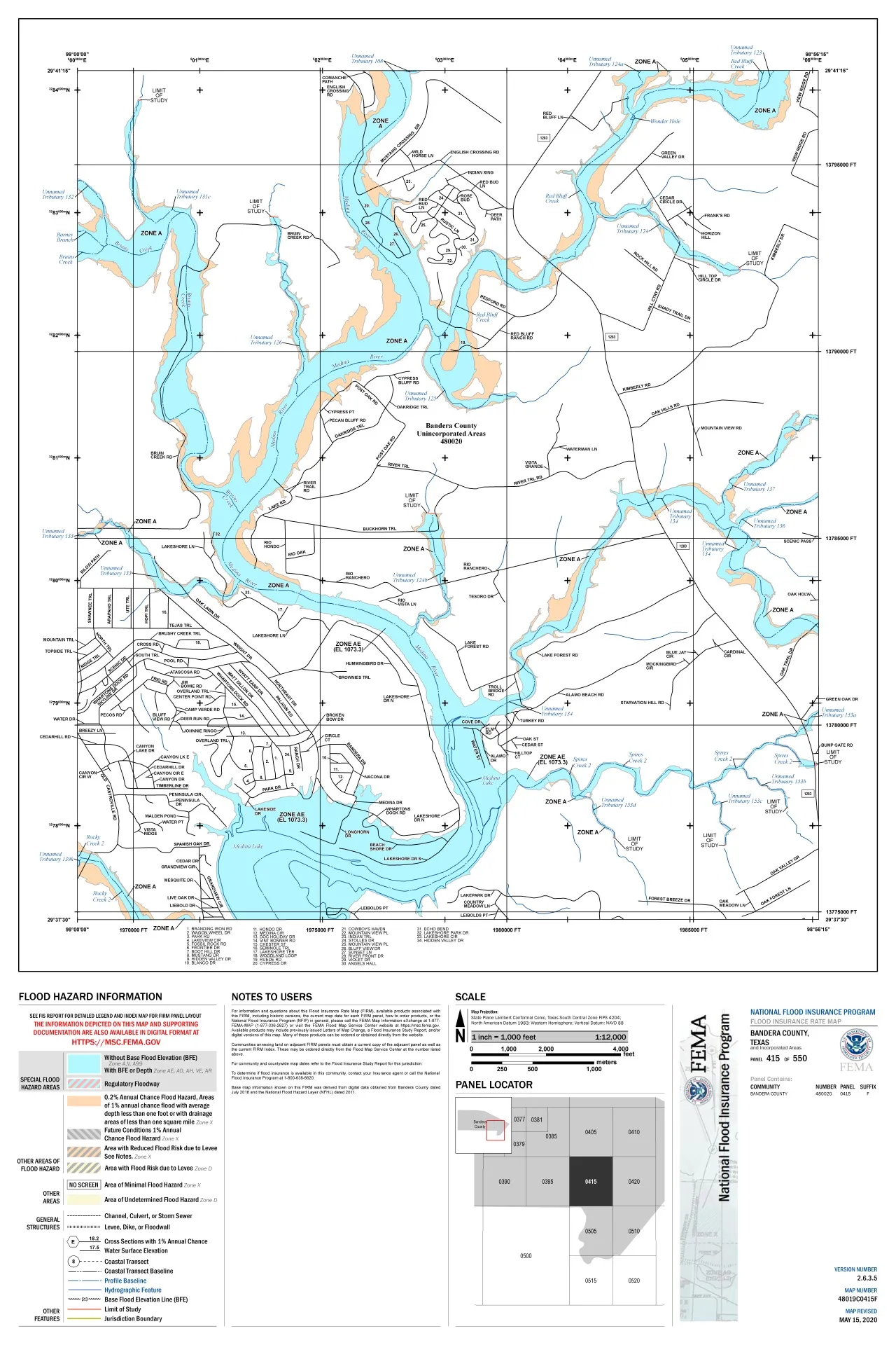
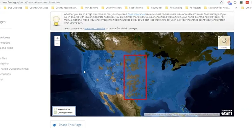

An older or historical map can help research how mapping changed, but it does not replace the currently effective FIRM. If the search shows no modern digital layer, use the products FEMA provides for that community and contact the local floodplain administrator for help identifying the effective map.
Step 5: ask the local floodplain administrator
Contact the city or county floodplain office before building, placing fill, installing a culvert, grading, or relying on a zone for a purchase decision. Ask about local studies, recent flooding, permit requirements, elevation certificates, freeboard, drainage standards, Letters of Map Change, and records for the specific parcel. Local requirements can be more protective than the minimum shown on a FEMA map.
Flood insurance decisions should be confirmed with the lender and a licensed insurance professional using current property and elevation information. A lender’s requirement is not the same as actual flood risk: insurance may still be worth considering outside a mapped high-risk zone.
Common mistakes to avoid
- Treating unshaded Zone X as zero flood risk.
- Using the parcel line in county GIS as a surveyed boundary.
- Assuming a historical panel overrides the effective map.
- Reading only the map color without the legend, panel date, and zone label.
- Treating the absence of a high-risk zone as proof that drainage, access, septic, or construction will work.
- Relying on a screenshot after maps, terrain, or local rules have changed.
Free online maps are an excellent first screen. For a high-stakes purchase, permit, elevation, or insurance decision, combine them with current official records and parcel-specific professional review.
See our lake lots for sale in Texas and Oklahoma lake communities.


