To find Texas land for sale, use five source types together: listing portals, the correct county appraisal district, county land records, map and environmental tools, and parcel-specific local authorities or professionals. Each answers a different question; none proves that a parcel is suitable, accurately priced, or a good purchase.
Compare the five research resources
| Resource type | Coverage and useful fields | Sold-data and freshness limits | What it cannot prove |
|---|---|---|---|
| 1. Listing portals | Advertised inventory; asking price; acreage; photos; description; days or status where shown | Coverage depends on the portal and feed; status and fields can change; an asking price is not a closed price; public sold displays may be partial | Title, legal access, exact boundaries, utilities, buildability, condition, value, or a bargain |
| 2. County appraisal district | County appraisal records; parcel/account ID; displayed owner; legal description; appraisal acreage; map; improvements; exemptions; appraised value; taxing units where available | Update timing and fields vary; Texas law can restrict disclosure of sales information obtained from private sources | Current title, precise boundaries, legal access, permitted use, utility capacity, market value, or purchase price |
| 3. County clerk and recorded land records | Deeds, plats, easements, restrictions, liens, releases, and other indexed instruments available in that county | Indexing and online image availability vary; recently filed documents may not appear immediately | A complete title opinion, absence of unrecorded interests, a surveyed boundary, or physical site condition |
| 4. Maps and environmental screeners | Road and area context, imagery, terrain clues, mapped flood hazards, and soil information | Imagery and map editions have dates; coverage and resolution vary; official maps may be revised | Legal access, boundary location, current conditions, permits, septic approval, or engineering feasibility |
| 5. Local authorities and qualified professionals | Parcel-specific rules, service availability, estimates, site findings, title work, surveys, appraisals, or technical opinions within each provider’s scope | Answers depend on the exact parcel, proposed use, date, records reviewed, and engagement scope | Any issue outside the authority’s or professional’s assigned role |
1. Search listing portals for candidates
HAR.com, Zillow, and Redfin can expose different advertised inventory and fields. Search more than one portal, filter for lots or land, and save the URL and date checked. Compare location, acreage, access claims, utilities, restrictions, terrain, improvements, and intended-use compatibility rather than sorting only by price per acre.
Do not call one app universally “best.” Portal coverage, filters, feeds, and display rules vary by place and over time. HAR’s public sold pages state that the displayed results are limited to REALTOR-listed properties added to HAR.com. A public sold display is therefore not a complete market dataset, and an active asking price is not a closed sale price.
2. Match each candidate to the county appraisal district
Use the official appraisal district for the county where the parcel is located. The Texas Comptroller’s county directory provides county appraisal-district and tax-office contacts. Search by parcel or account ID when possible, then reconcile the legal description, appraisal acreage, map, owner display, improvements, exemptions, appraised value, and taxing units.
Fields and update timing vary by district. The Travis Central Appraisal District FAQ explains that each Texas county is served by an appraisal district and that private-source sales information is restricted from public disclosure. That limitation is one reason appraisal records should not be treated as a complete closed-sales database or as proof of current market value.
3. Review county land records
Use the county clerk’s recorded-land-record system to look for deeds, plats, easements, restrictions, liens, releases, and other instruments tied to the legal description or parties. Online indexing and document images vary by county. Finding a deed is useful evidence but not a complete title examination, and a recorded plat does not confirm that monuments or improvements are where a web map depicts them.
4. Screen location, flood, and soils
Use Google Maps or another map for initial road and neighborhood context, then check the imagery date where shown. For flood research, use the FEMA Flood Map Service Center, which FEMA identifies as the official public source for NFIP flood-hazard information. For soils, the USDA Web Soil Survey provides soil survey data and notes that on-site investigation is needed for some engineering and soil-quality applications.
Maps are screeners, not approvals. Confirm legal access, boundaries, current site conditions, drainage, utilities, septic feasibility, and the proposed use through the relevant records, authorities, site work, and qualified professionals.
5. Verify the exact parcel locally
Ask the city or county about current land-use and permit requirements for the proposed use. Ask road and utility authorities or providers about the exact parcel rather than a nearby address. When appropriate, use a land-experienced broker, appraiser, title professional, attorney, surveyor, engineer, environmental professional, or septic professional, and record the source, date, assumptions, and scope of each answer.
Organize a comparable-property worksheet
For every candidate, record the source URL, date checked, listing or closed status, acreage, total price, location, access, utilities, restrictions, terrain, flood and soil screening, intended use, and unresolved questions. Calculate price per acre only after removing materially different properties. For a deeper method, use How to Estimate Texas Land Value.
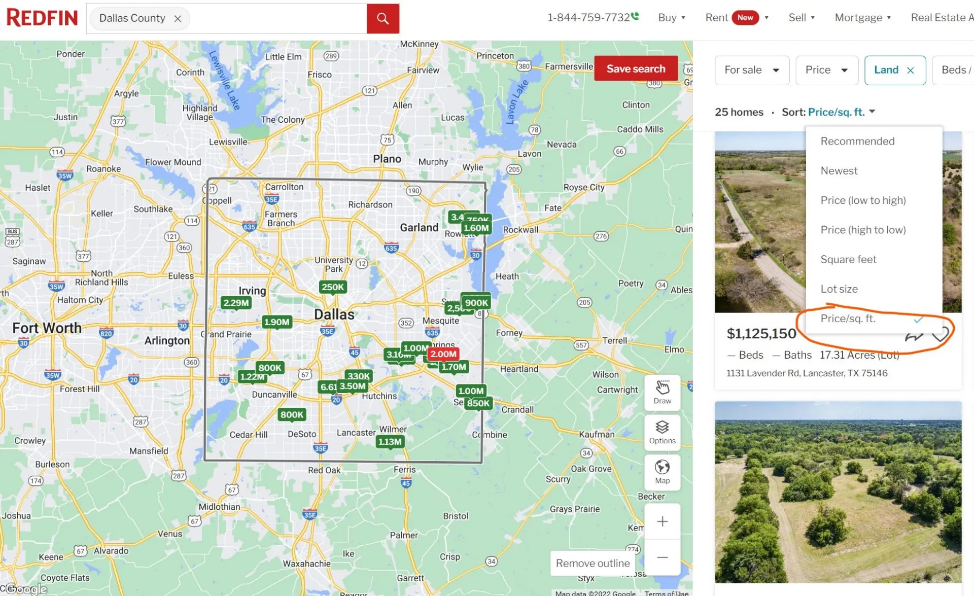
Legacy worksheet example retained from the original article; interface and portal fields may have changed since this image was captured. Sorting by unit price does not establish value.
Continue from discovery to due diligence
Browse current Texas land listings to identify candidates, then independently verify every fact important to the intended use. You can also contact the Elegment Land team with listing-specific questions.
Every lot we sell lists its price, GPS corners, utilities and rules. Browse our Texas land for sale.