
Buying land starts with verifying the parcel, not simply liking the location or price. This resource center helps you research who owns the property, where its boundaries appear to be, how to locate county parcel records, and whether flood risk, zoning, drainage, soil, access, taxes, or other restrictions could affect your plans. You will find practical walkthroughs for using county assessor and GIS websites, comparing parcel maps with FEMA flood maps, and using GPS coordinates to visit land that may not have a street address. Because online maps and GPS have limits, the guides also explain when preliminary research is not the same as establishing an exact legal boundary. Use these articles to organize questions, check information against official local sources, and identify issues that deserve closer review before you buy, build, or make improvements. Requirements vary by parcel and jurisdiction, so confirm current details with the relevant county offices and qualified professionals.
Buying Land & Due Diligence
Latest Articles




Questions about Buying Land & Due Diligence
What should I check before buying vacant land?
Start with ownership, parcel identity, legal access, boundaries, zoning or use restrictions, flood exposure, drainage, soil, utilities, and property taxes. Match each finding to your intended use rather than assuming that vacant land is automatically buildable. County assessor, clerk, planning, GIS, and FEMA resources can help you assemble an initial picture before seeking parcel-specific professional guidance.
How can I verify who owns a parcel?
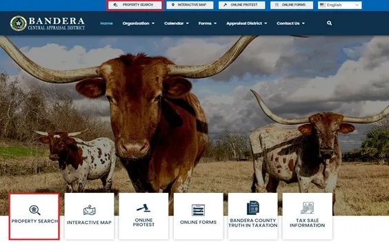
Find the county where the land is located, then search the official county assessor or appraisal district website by parcel number, owner name, or address. The county clerk or recorder maintains recorded deeds, while assessor databases may update later. If online ownership details are unavailable or appear outdated, contact the appropriate county office directly and ask how to review the current record.
How do I check whether land is in a flood zone?
Locate the parcel through its county GIS or assessor map, note the parcel ID and approximate boundaries, and compare that location with FEMA’s Flood Map Service Center. Search by address, coordinates, or location, then review the mapped flood zone and related information. Because maps and conditions can change, confirm what the result means for your plans with the appropriate local authority or professional.
Can GPS coordinates show my exact property lines?
GPS coordinates and interactive maps can help you navigate to a parcel, understand its general shape, and look for corner markers. They do not necessarily establish the exact legal boundary. Phone accuracy, map alignment, and missing markers can create uncertainty, so treat GPS as a field-navigation tool and use a qualified surveyor when precise boundary placement matters.
